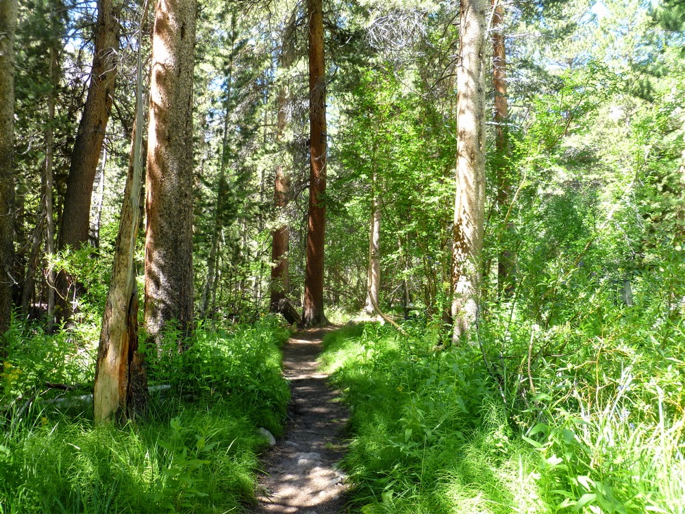
I hiked / ran this amazing hike up to the Big Pine Lakes in August 2013.
About a mile and half in it's green and a heady creek of cold water runs nearby.
Lake 1. The aquamarine color is because it is fed by glaciers.
Lake 2. The rock formation here is amazing.
Lake 4. This is one of the two lakes that people fish at. The water is not as cold since it is on the other side of the valley.
Lake 5. This is a cold lake. I sat here for about 10 minutes and ate what little food I had left. It was very quiet except for the wind and the water lapping on the rocks. This was the highest altitude I got on the trail. There is one more lake further on but it's a bit off trail and not easy to find.
Black Lake, on the way back down the trail.
This is Lon Chaney's old cabin [built in 1929 -30] which you can check out either on the way up on the way back. It's now a ranger station.
This trail is highly recommended. Especially in the summer when it is much cooler than it is in the valley not so far below.
Miles: 9 or 10
Time: 5 1/2 hours hiking quickly and occasionally running.
Showing posts with label california. Show all posts
Sunday, April 13, 2014
Friday, May 25, 2012
Garapito Trail
One of the rarely tread trails in Topanga State Park is the Garapito Trail. One reason is because if you hike it you have to be prepared to be out longer than the casual hike allows. Plus, if you approach it from the valley side, off of Mulholland drive, it starts downhill for the first mile-and-a-half. And most people choose to, instead, stay on the fire road to the hub junction because it seems the more natural way to go.
If you approach it from the Topanga Park side it takes even longer to get to the trail and loop around. But this is one reason it is such a cool trail; It's out of the way.
The loop trail starts at the top of Reseda Blvd, which is accessed off the Reseda Blvd exit off the 110 in Tarzana.
I did this trail at the beginning of May 2012.
After about 8 minutes of running downhill on the fire road you come to the trail sign.
Continue downhill into the valley.
Press on upward out of the valley after about 25 minutes of running.
The trail has many switchbacks with lots of overhanging branches and brush. Most people have to duck a lot to stay under the branches.
If you approach it from the Topanga Park side it takes even longer to get to the trail and loop around. But this is one reason it is such a cool trail; It's out of the way.
The loop trail starts at the top of Reseda Blvd, which is accessed off the Reseda Blvd exit off the 110 in Tarzana.
I did this trail at the beginning of May 2012.
After about 8 minutes of running downhill on the fire road you come to the trail sign.
Continue downhill into the valley.
Press on upward out of the valley after about 25 minutes of running.
The trail comes out after 40 minutes to Eagle Rock, which is to the right of where the trail goes. But it's tough to deny the desire to take a detour to the top of the rock. [Which for some reason in the photo looks smaller than it is].
The trail is now all fire road as it heads back in a loop to hub junction and then back to the valley side.
Distance: 7 miles
Total Time 72 minutes
Monday, May 07, 2012
Montaña de Oro
A few miles outside of San Luis Obisbo along the Pacific coast lies
Montaña de Oro State Park.
There are a good many trails to explore.
I took the most obvious one, which is up Valencia Peak. It's not a very
long run but it is challenging and you get a nice variety from sand to
rock. Plus, the view of the surround region is
amazing.
On the way up looking out toward the ocean.
Looking down from the top.
Hard to keep one's eyes on the trail with such a view.
After all the steep running I chose to run by the bluffs.
Looking back up where I ran. Valencia Peak is to the left.
Had I wanted to do a longer run I could have gone to the other peak to the right, which is Oats Peak.
Distance: 5 miles
Total Time 45 minutes
Friday, April 27, 2012
Mt Tam trails
Each spring I take a trip to the Bay Area to see relatives and I make it a point to take a run on the trails around Mt Tamalpais.
The trail I frequent is the Matt Davis trail. This stretch of it starts near the Throckmorton Fire Station.
[I ran this trail in May 2011.]
Heading along the Matt Davis Trail in the first mile.
After the steep Nora trail the trail comes out at a place called The West Point Inn, which offers a nice view of the bay.
Then I head along another trail to the Mountain Theater, where they are often prepping for a Spring show.
Coming down from the Mountain Theater is a steep section with a lot of switchbacks. Toward the bottom are some steps.
Then I loop back onto the Matt Davis Trail.
And then I finish the last mile going through nicely shaded areas and narrow trees.
Distance: 6 to 7 miles
Total Time: 65 to 70 minutes
Friday, May 27, 2011
Jesusita trail
I went up to Santa Barbara for the day and ran the Jesusita trail up to Inspiration point.
It was a foggy day, which was perfect.
After running alongside a creek for the first mile there is a cool old sign.
It has been a good rainy winter and spring as was evident by all the green along the trail.
Here is the top. A good amount of fog blocked any view. But it was fine with me since it kept me cool.
Coming back down the foliage seems to overtake the trail.
Distance: 6 to 7 miles.
Total Time: 80 minutes
Wednesday, May 26, 2010
Stinson trails
One of the pleasures of going to the Bay Area is to visit the trails on and around Mount Tamalpais.
One such set of trails is to drive [the very] windy road to Stinson Beach and then from there run up the Matt Davis Trail to Pantoll Station and then cruise down the [famous] Dipsea trail.
On the Matt Davis trail there are a good number of stairs on the trail. [As there are on Dipsea].
Almost at the top section of the Matt Davis trail looking back toward Stinson Beach.
On the top section of the Dipsea trail. Beautiful.
More stairs on the downhill section.
The view on the finishing mile is really something else. Classic.
Distance: 7 to 8 miles.
Total Time: 85 minutes
Sunday, May 09, 2010
Will Rogers
One of my favorite trail runs, close to where I live, is in Will Rogers State Park. The trail is the start of the 45 mile [or so] backbone trail, which extends all the way to Pt Mugu. I usually just run for 40 minutes up and then turn around at a particular spot.
The first section of the trail leads to a bridge, which you can see off to your right. This is the high spot of the first section. About 17 to 20 minutes of running.
The trail rolls along and has a lot of different green flora. Note the yucca [cactus] at the far end of the trail.
The toughest stretch is between the yucca and the oak tree. It's is about 7 minutes of punishing uphill that, fortunately has pretty good brush and tree coverage.
Once past the oak tree [not pictured] the trail gets flat for a while and has really nice shade. This is usually my cool down spot before the next section.
This is coming back from the top section. Other than the occasional mountain biker this section is usually very quiet. Hikers take too long to get here. There is no real high point on the trail but the views are still terrific all around.
Total Time: 73 minutes
Friday, May 01, 2009
Mt San Jacinto
You take a tram a few miles up the side of the mountain.
It took me from the 90 degree April heat to a cool 55 degrees and snow!
I went about a quarter mile and snow covered the trail. A couple coming down the trail told me the trail disappeared and that I had little chance of getting to the top. I nodded and continued on. I figured even if I didn't make it I was where I wanted to be and ready to keep going. Although, I then realizes that I had forgotten my long sleeve shirt, jacket and cap. Whoops! Was in too much of a hurry to catch the tram, which only runs every 20 minutes. Oh well, glad I had bought a long sleeve San Jacinto t-shirt at the gift shop before I hit the trail.
Oh yes, there is snow. Where is the trail?
Love it!
The snow pack was hard enough that I didn't fall in.
I met a guy along the way who told me the peak was to the left. I take his word for it. But, alas, the peak really was to the right.
After a long traverse I got into a small cul-de-sac valley and the trail completely disappears. I decide to head straight up a snow slope.
I get to a saddle and go left.
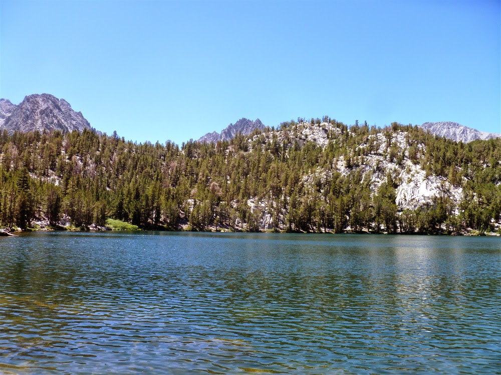
Beautiful. I'm made it. What a view. Wait. What is that peak over there? It's higher than the one I am on. I'm on the wrong peak!
I headed back down to saddle and through large boulders and snow. I finally reached the true summit of Mt San Jacinto.
I looked back at the first peak I climbed. Okay, I was definitely on the higher peak now.
Beautiful.
Way, way down in the valley below [back and to the right] it was 95 degrees and Coachella was going on.
I'm sure it was cool but I was hearing the music of the mountains.
Total Time: Around 4 hours
Wednesday, February 20, 2008
Canyon & Field
A canyon and field in the Santa Monica mountains that shall remain unnamed.

Toward the start of the hike [or run].

Their is water running along and across the trail from January to May.

The field stretches for a long way up toward that rock formation.

The trail continues in a zig zag of sorts.

A piece of...well something cool and old.

If you're running the trail [I was] this is the view you get back over your shoulder at about 30 minutes.
Distance: 6 to 7 miles
Total Time: 75 minutes
Subscribe to:
Posts (Atom)