Friday, May 25, 2012

Garapito Trail

One of the rarely tread trails in Topanga State Park is the Garapito Trail. One reason is because if you hike it you have to be prepared to be out longer than the casual hike allows. Plus, if you approach it from the valley side, off of Mulholland drive, it starts downhill for the first mile-and-a-half. And most people choose to, instead, stay on the fire road to the hub junction because it seems the more natural way to go.
If you approach it from the Topanga Park side it takes even longer to get to the trail and loop around. But this is one reason it is such a cool trail; It's out of the way.
The loop trail starts at the top of Reseda Blvd, which is accessed off the Reseda Blvd exit off the 110 in Tarzana. 

I did this trail at the beginning of May 2012.

 After about 8 minutes of running downhill on the fire road you come to the trail sign.

 Continue downhill into the valley.

 Press on upward out of the valley after about 25 minutes of running.

The trail has many switchbacks with lots of overhanging branches and brush. Most people have to duck a lot to stay under the branches.

 
The trail comes out after 40 minutes to Eagle Rock, which is to the right of where the trail goes. But it's tough to deny the desire to take a detour to the top of the rock. [Which for some reason in the photo looks smaller than it is].

The trail is now all fire road as it heads back in a loop to hub junction and then back to the valley side.

Distance: 7 miles
Total Time 72 minutes

Thursday, May 17, 2012

La Plata mountains

One of the trails I ran a lot when I was in college was a trail in the La Plata Mountains outside of Durango Colorado. It's a trail without a particular name mostly because it is on private property and not supposed to be hiked or run. But when you want a killer workout off the beaten [and beautiful] path [which we did] then this was it.
The trail doesn't have a name that I know of but it may be Eagle Pass according to my perusing through Google Earth.

I did this run in June 2010.

The start of the trail crosses a creek.

After about 30 minutes of running you look back and get this view.

Just cruising along.

Spectacular view. The area has an old mine. This building is a relic of its past.

Near the top.

At the top.

Distance: 9 miles [?]
Time: 3 hours

Monday, May 07, 2012

Montaña de Oro

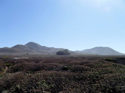
A few miles outside of San Luis Obisbo along the Pacific coast lies Montaña de Oro State Park. There are a good many trails to explore. I took the most obvious one, which is up Valencia Peak. It's not a very long run but it is challenging and you get a nice variety from sand to rock. Plus, the view of the surround region is amazing.

On the way up looking out toward the ocean.

Looking down from the top.

Hard to keep one's eyes on the trail with such a view.

After all the steep running I chose to run by the bluffs.

Looking back up where I ran. Valencia Peak is to the left.
Had I wanted to do a longer run I could have gone to the other peak to the right, which is Oats Peak.

Distance: 5 miles
Total Time 45 minutes

Wednesday, May 02, 2012

Kitchen Mesa

Ghost Ranch, New Mexico has a few trails that offer a beautiful view of the high desert terrain. One of the best is Kitchen Mesa. Seen from the front in the photo above. The trail goes to the top of the rock.

Seen from the back side.

After run / hiking about 20 minutes this is the view you get looking back from where you have hiked.

Then the trail gets crazy. All rocks and hard to find an actual trail. You need to grab the rope [tough to see] that is available.

 The top goes along for a bit.

Once at the very top - after 40 minutes running - you get this view of the ranch.

Looking to the left you get this view. The flat top mountain in the distance is Pedernal.

Kitchen Mesa is a good hike with great views. Running all of it is not possible but that won't prevent you from a good workout in part because it is above 7000 feet altitude.

Distance: 6 miles [?]
Total Time: 80 minutes [the hike apparently takes 3 hours]

Cool Blogs